Neighborhood Heat Modeling
Go beyond air temperature with a mean-radiant temperature model that takes into account factors like urban geometry, shadows, and surface materials. Understand how potential heat solutions impact thermal comfort at a micro-scale.
Deliverable
Report characterizing baseline and/or modified mean-radiant temperature for your neighborhood. Spatial assets with metadata.
Process
SOLWEIG model at 1m resolution for areas up to 12 square kilometers, UTCI assessments at points of interest.
Impacts
Human comfort insights
Scenario planning
Resilient design
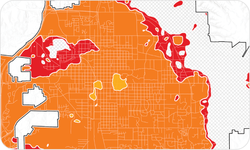
Project Example
Jackson, Mississippi

CAPA used the SOlar and LongWave Environmental Irradiance Geometry model (SOLWEIG) to compare simulated mean radiant temperature (MRT) and Universal Thermal Climate Index (UTCI) conditions before and after the Farish Street Redevelopment project. Site plans were digitized to reflect tree planting, land cover changes, and construction of shaded pergolas. Before/after results showed average daytime reductions of 15-20°F MRT in shaded areas and up to 40-50°F reductions at peak hours. UTCI assessments showed reductions of thermal heat stress from very strong/strong to strong/moderate in specific locations.
Check Out Our Other Services


Air Quality Monitoring
Extreme Heat Projections


Intervention Guidebook